Query Facade Data
Draw a boundary on the map to load OpenStreetMap building footprints and pre-processed facade material data.
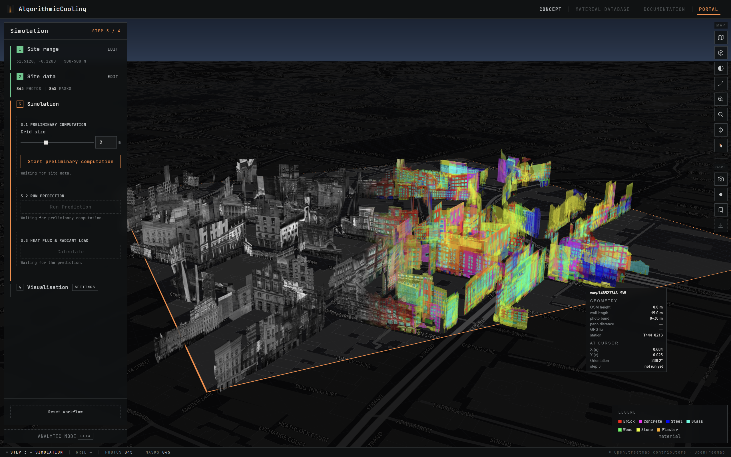

Algorithmic Cooling transforms street-level imagery into facade material data, enabling urban-scale facade thermal behavior simulations to evaluate the impact of changing urban materials.
Select a street block, run the simulation, read the façades in 3D. London test site · 51.5158, -0.1259
Draw a boundary on the map to load OpenStreetMap building footprints and pre-processed facade material data.
An ML surrogate model estimates hourly surface temperatures, heat flux and radiation load calculates based on the prediction results.
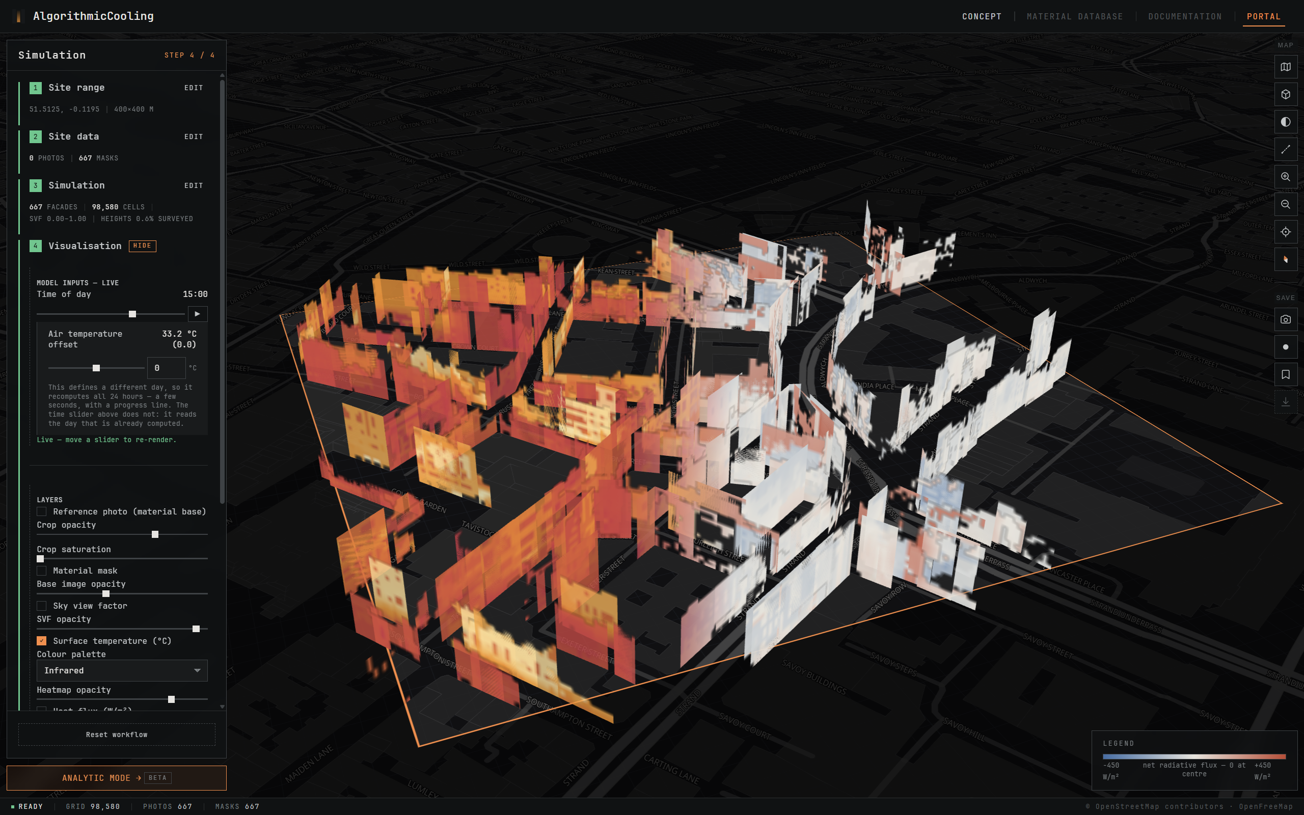
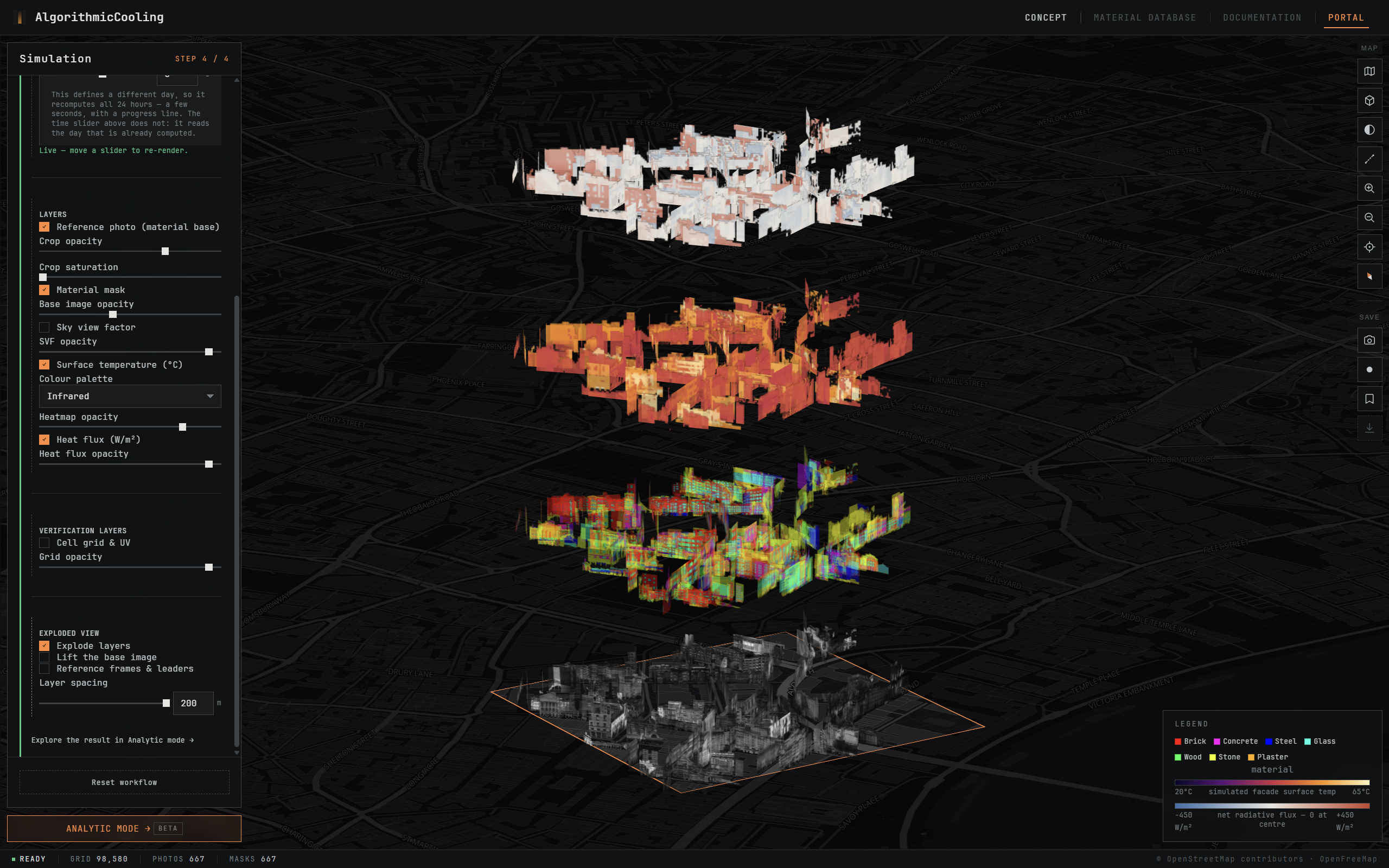
Expand the layers, explore the urban vertical surfaces, material masks, and heat results in layers.
Simulated results are categorized into heat zones from hot to cold, visualizing how heat affects the street canyon.
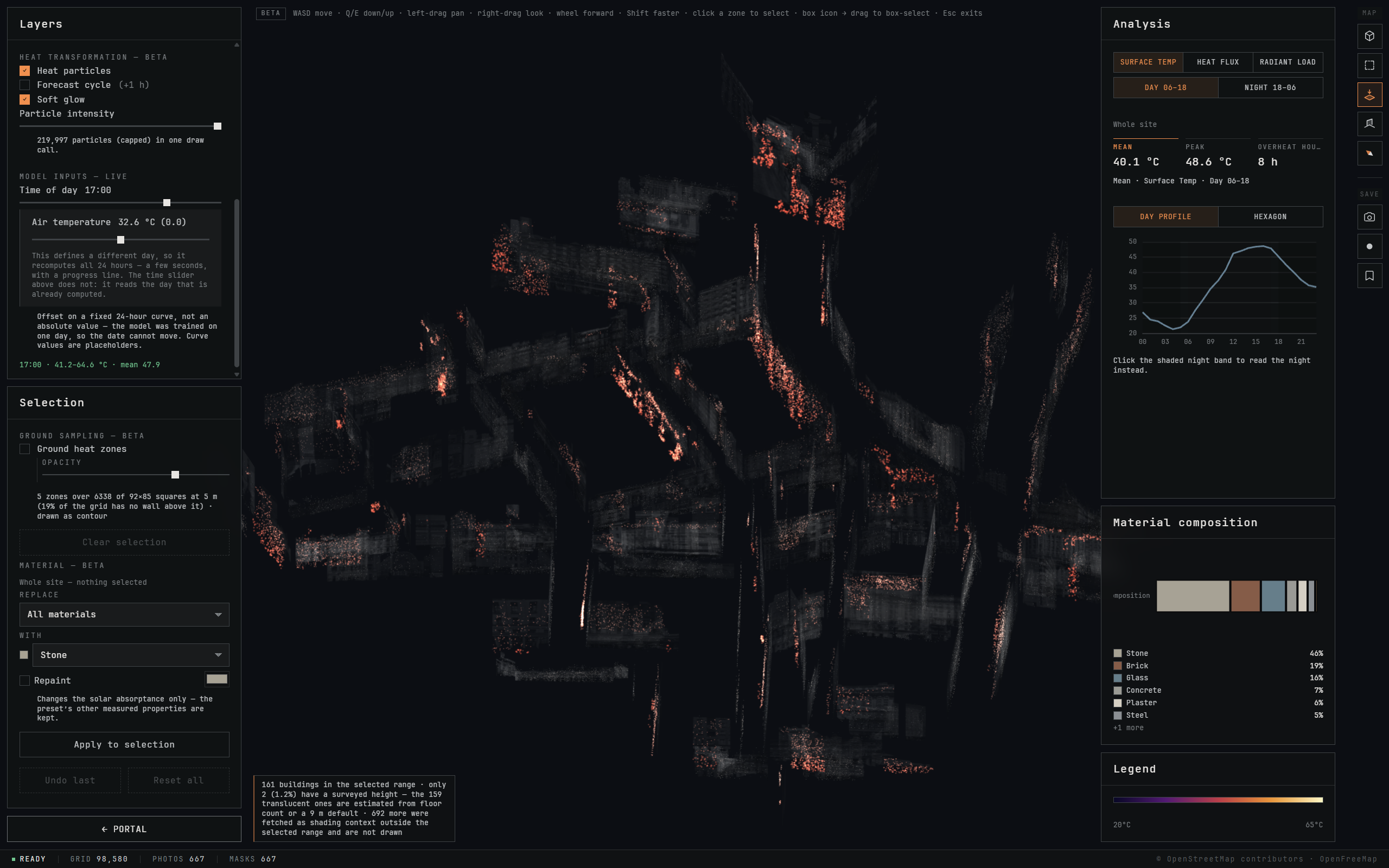
Select surfaces, alter facade materials, and test material compositions. The system automatically re-runs the model.
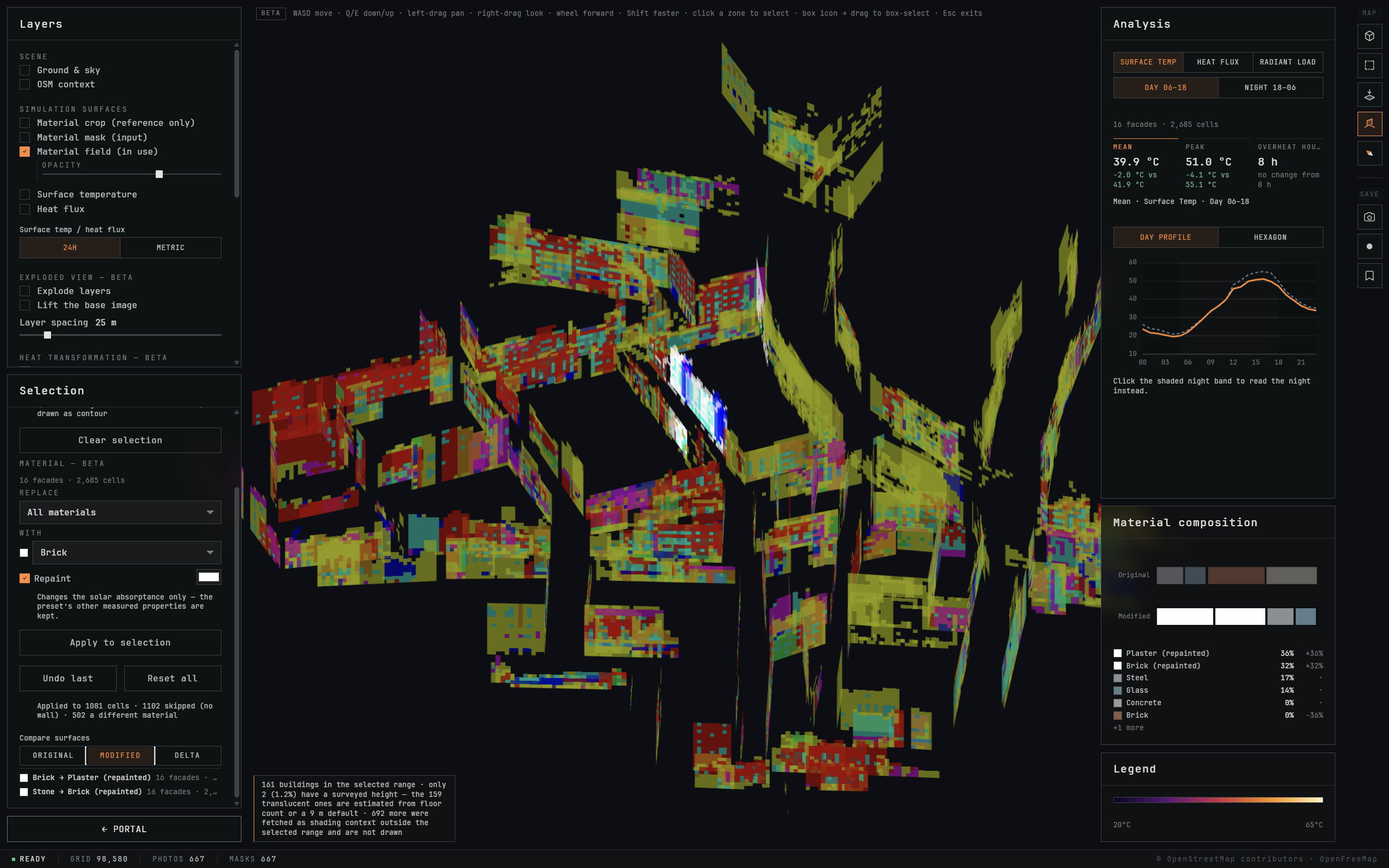
Analyze changes with comparative metrics and charts to evaluate microclimate impacts and thermal trade-offs.
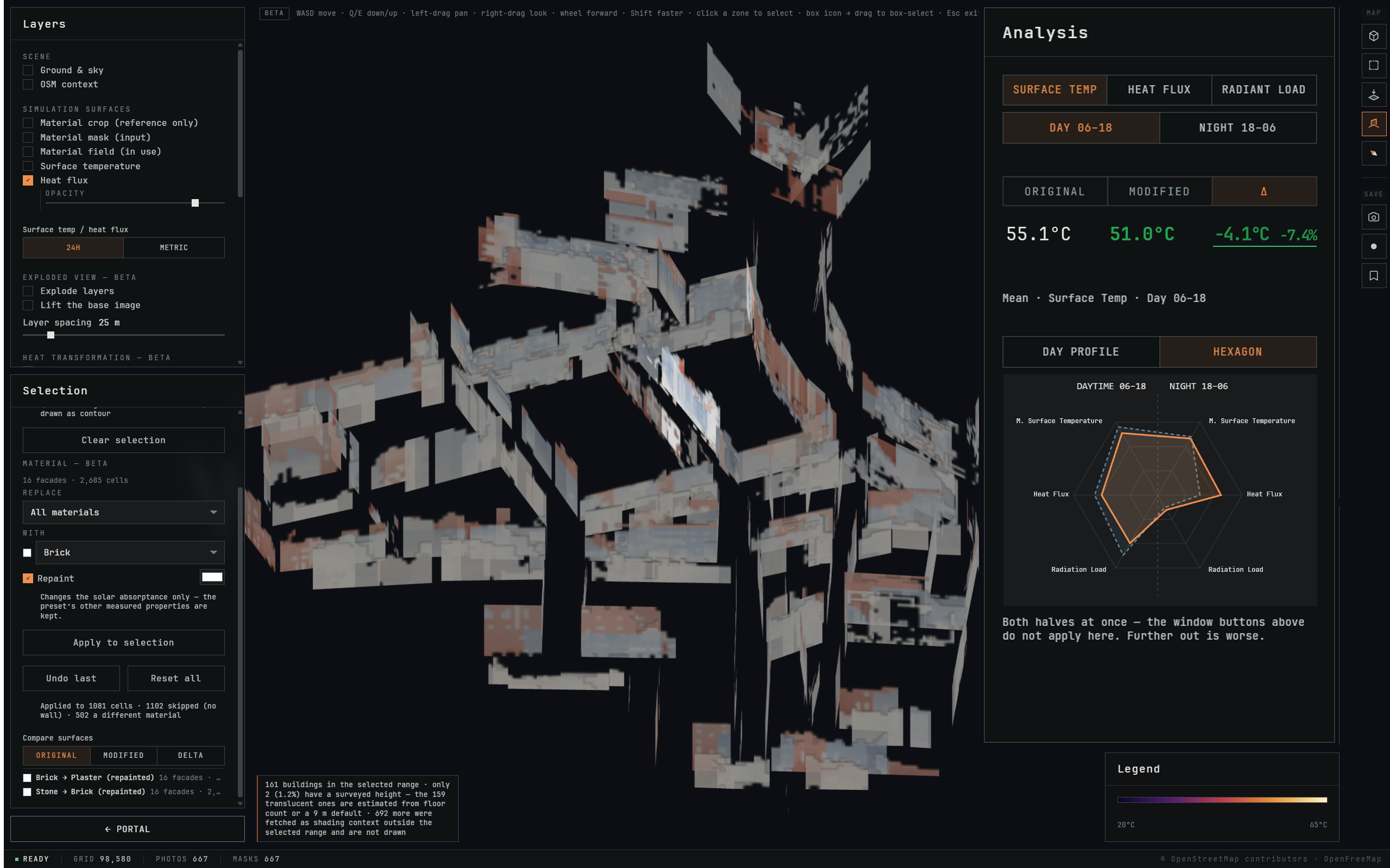
Transforming raw data into urban vertical material data.
Select a block, run the simulation, read the façades in 3D.
Methods and User Instructions to support the platform.
Bridging current design & planning tools to inform design decisions.